Category World Atlas

Which is the largest desert in Antarctica?

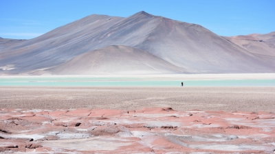
The largest desert on earth is the Antarctic desert, covering the continent of Antarctica with a size of around 5.5 million square miles. The term deserts includes polar deserts, subtropical deserts, cold winter and cool coastal deserts, and are based on their geographical situation.

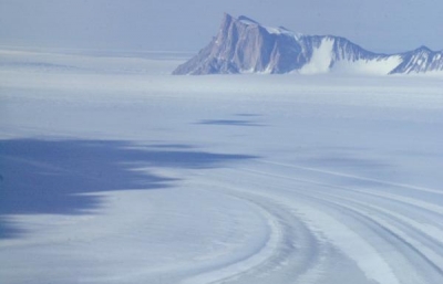
Like most global deserts, the Antarctic covers the entire continent. In fact, an astonishing 98 percent is permanently covered by a sheet of ice. It is considered a desert because it rains on average only 10 mm every year. Some experts even believe that certain parts located away from the coast have not had rain in the past 14 million years.

It’s covered by a permanent ice sheet that contains 90% of the Earth’s fresh water. Only 2% of the continent isn’t covered by ice, and this land is strictly along the coasts, where all the life that is associated with the land mass (i.e. penguins, seals and various species of birds) reside. The other 98% of Antarctica is covered by ice which averages 1.6 km in thickness.

There are no permanent human residents, but anywhere from 1,000 to 5,000 researchers inhabit the research stations scattered across the continent – the largest being McMurdo Station, located on the tip of Ross Island. Beyond a limited range of mammals, only certain cold-adapted species of mites, algaes, and tundra vegetation can survive there.


Picture Crdit : Google

Which is the largest desert in South America?

 The Atacama Desert is on the other side of Eastern Patagonia. Therefore, you will find that it is surrounded by the Andes in its eastern part and by the Pacific Ocean in the west. The Atacama Desert is known as the driest non-polar place in the world. It could be several years without rain in one of the largest deserts in South America.

The desert occupies an area of about 105,000 square km. Large sections of the desert feature salt lakes, sand, felsic lava, and stony terrain. The Atacama Desert is known to be the world’s driest non-polar location. In the central sector of the desert, rainfall often does not occur for periods of up to four or five years. The species diversity of the Atacama Desert is highly restricted. Some parts of the desert are too dry to sustain any life form at all. Scorpions, desert butterflies, and wasps, the Atacama toad, lava lizards, iguanas, etc., are some of the Atacama Desert fauna. Birds visiting or residing in the desert include sparrows, hummingbirds, Andean flamingos, Humboldt penguins, etc. Seals and sea lions can be sighted along the coast.

Much of the Atacama Desert’s core is caked in thick salt deposits called playas, which can stretch for miles and are nearly half a meter thick (1.6 feet) in some places. The desert is speckled with stones that have been carried across the playas by powerful wind gusts. Alluvial fans, which are large, fan-shaped sediment deposits, connect the desert plateau with the mountains that surround it and suggest that water once flowed from the Andes into the desert.


Picture Credit : Google

Which is the largest desert in North America?

The Chihuahuan Desert is the largest hot desert in North America, located in the Southwestern United States and Northern Mexico. Its total area is 140,000 sq mi (360,000 km2).

Though the Chihuahuan Desert is the southernmost, it lies at a fairly high elevation and is not protected by any barrier from arctic air masses, so hard winter freezes are common. Its vegetation consists of many species of low shrubs, leaf succulents, and small cacti. Trees are rare. Rainfall is predominantly in the summer, but in the northern end there is occasionally enough winter rain to support massive blooms of spring annuals. The Chihuahuan Desert is unexpectedly rich in species despite the winter cold.

The eastern boundary of the Chihuahuan Desert is one of the oldest and richest centers of plant evolution on the North American continent. A wide variety of vegetation communities are present in the in the ecoregion, ranging from desert shrublands at lower elevations and conifer woodlands at the highest elevations. The Chihuahuan Desert boasts as many as 3,500 plant species, including nearly a quarter of the world’s cactus species. Approximately 1,000 of the plant species grow only in this ecoregion. Some distinctive habitat types in the Chihuahuan Desert include yucca woodlands, playas, gypsum dunes, and a diverse array of freshwater habitats. Vast desert grasslands and a wide variety of yuccas and agaves, including many endemic species, also make this desert extremely unique.

The Chihuahuan Desert is home to more than 170 species of amphibians and reptiles. At least 18 of these species are endemic to the Ecoregion. There are a surprisingly large number of endemic fish that occur in the Chihuahuan Desert as well—nearly half of the 110 fish species in the region are either endemic or of limited distribution. Most are relic species found in isolated springs in the closed basins.


Picture Credit : Google

Which is the largest desert in Africa?

The Sahara is one of the harshest environments on Earth, covering 3.6 million square miles (9.4 million square kilometers), nearly a third of the African continent, about the size of the United States (including Alaska and Hawaii). The name of the desert comes from the Arabic word ?a?r??, which means “desert.”

The Sahara desert has a variety of land features, but is most famous for the sand dune fields that are often depicted in movies. The dunes can reach almost 600 feet (183 meters) high but they cover only about 15 percent of the entire desert. Other topographical features include mountains, plateaus, sand- and gravel-covered plains, salt flats, basins and depressions. Mount Koussi, an extinct volcano in Chad, is the highest point in the Sahara at 11,204 feet (3,415 m), and the Qattara Depression in Egypt is the Sahara’s deepest point, at 436 feet (133 m) below sea level.

Camels are one of the most iconic animals of the Sahara. The large mammals are native to North America and eventually made their way across the Bering Isthmus between 3 and 5 million years ago, according to a study in the Research Journal of Agriculture and Environmental Management in 2015. Camels were domesticated about 3,000 years ago on the Southeast Arabian Peninsula, to be used for transportation in the desert, according to the University of Veterinary Medicine, Vienna.

Plant species in the Sahara have adapted to the arid conditions, with roots that reach deep underground to find buried water sources and leaves that are shaped into spines that minimize moisture loss. The most arid parts of the desert are completely void of plant life, but oasis areas, such as the Nile Valley, support a large variety of plants, including olive trees, date palms and various shrubs and grasses.


Picture Credit : Google

Which is the largest desert in Asia?

Gobi Desert, the largest desert in Asia, promises stunning sand dunes, dinosaur fossils, and warm hospitality from nomad families and friendly Bactrian camels. 

Spanning across 1,295,000 square kilometres, the desert lies in the dry region of the Tibetian Plateau, extending from northern China to Mongolia and passing through several trading cities along the historical Silk Road including Turpan, Hami and Dunhuang. 

Extending from northern China into Mongolia, the Gobi Desert receives an average of 7 inches of rainfall each year because the Himalaya Mountains block rain clouds from reaching the region. The Silk Road actually passes through the Gobi Desert, and through historic trading cities such as Turfan, Hami and Dunhuang. Today, the Gobi continues to grow every year, as winds carry desert sand into nearby areas and erodes the surrounding top soil. This process of desertification renders fertile land unusable and occurs in the Gobi at an alarming rate for the nearby human population. Gobi is not one thing. But it comprises of 33 Gobi with different features and climate. Gobi has canyon, flowery steppe, beautiful crags, wide hollows with few oases, saline and green saxaul thickets. The Gobi Desert is not only famous for dinosaur species discovery, but also well known for its rich natural resources. The Gobi Desert is rich in copper, gold and coal deposits. One of them is called Oyu Tolgoi which is world’s third largest copper and gold mine.


Picture Credit : Google

Which is the longest river in Australia?

The calculations confirmed that Australia’s longest single river is the River Murray at 2508 kilometres. However, if the longest tributaries of the Darling River, the Culgoa, Balonne and Condamine, are taken into account its total length increases to 2740 kilometres, making it Australia’s longest waterway.

The National Topographic Database is a nationally consistent dataset containing a range of topographic features, such as relief and drainage, which has been captured and maintained at a scale of 1:250 000 for the whole of Australia. Use of the database to digitally calculate the longest rivers has resulted in more precise estimates than those available previously.

The Murray River was first discovered by European explorers Hamilton H. Hume and William H. Hovell in 1824. It wasn’t until five years later, however, that Charles Sturt navigated down the Murrumbidgee to encounter the Murray and named it after Sir George Murray, (Soldier and Tory Party Politician 1772-1846) when his exploration party encountered the Darling connection. Sturt had previously explored the Darling River to the north and was able to determine that they were indeed the same river system.

The Murray River is the world’s 16th-longest river at 2,520 kilometres from its source in the Kosciusko National Park. It is fed by several rivers on it’s journey from the Australian Alps. The main feeding rivers are the Darling and Murrumbidgee Rivers. The Darling River (2,740 kilometres) begins in the far inland of Australia (Queensland) and joins the Murray at Wentworth (NSW) then flows to the Southern Ocean through South Australia.


Picture Credit : Google