Category Geography

Which river is largely referred to as Tsangpo throughout its upper case?

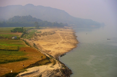
The Brahmaputra called Yarlung Tsangpo in Tibet, Siang/Dihang River, in Arunachal Pradesh and Luit, Dilao in Assam, is a trans-boundary river which flows through Tibet, India and Bangladesh. It is the ninth largest river in the world by discharge, and the 15th longest.

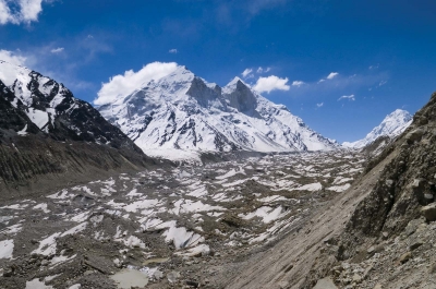
The BrahmaputraRiver originates in the Chemayungdung mountain ranges which nearly sixty miles south-east of Mansarovar lake in the MountKailash range in Southern Tibet at an elevation of 5300 m.A spring called Tamchok Khambab spills from the glaciers which later gather breath and volume to become the Tsangpo, the highest river in world.

Apart from the name Tsangpo, the Brahmaputra is also known by its Chinese name, Yarlung Zangbo in Tibet.  There are several tributaries of Tsangpo in Tibet. Before entering India, the river passes Pi (Pe) in Tibet and suddenly turns to the north and northeast and cuts a course through a succession of great narrow gorges between the mountain Gyala Peri and Namjabarwa (Namcha Barwa) in a series of rapids and cascades.

In India the total basin area of BrahmaputraRiver is 197 316 sq. km. which 5.9% of the total geographic area of the country. In India the river is spread over states of Arunachal Pradesh, Assam, West Bengal, Meghalaya, Nagaland and Sikkim.


Picture Credit : Google

The Harappan civilization flourished around which river valley?

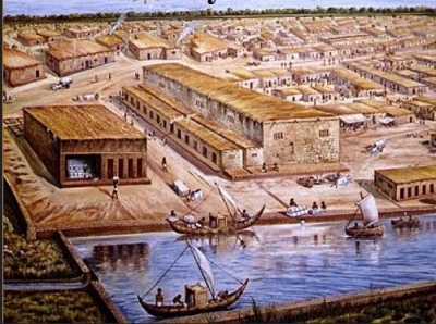
The Harappan civilization was located in the Indus River valley. Its two large cities, Harappa and Mohenjo-daro, were located in present-day Pakistan’s Punjab and Sindh provinces, respectively. Its extent reached as far south as the Gulf of Khambhat and as far east as the Yamuna (Jumna) River.

Before the excavation of these Harappan cities, scholars thought that Indian civilization had begun in the Ganges valley as Aryan immigrants from Persia and central Asia populated the region around 1250 BCE. The discovery of ancient Harappan cities unsettled that conception and moved the timeline back another 1500 years,situating the Indus Valley Civilization in an entirely different environmental context.

The Indus River Valley Civilization is considered a Bronze Age society; inhabitants of the ancient Indus River Valley developed new techniques in metallurgy—the science of working with copper, bronze, lead, and tin. Harappans also performed intricate handicraft using products made of the semi-precious gemstone Carnelian.


Picture Credit : Google

On which river bank is the Taj Mahal situated?

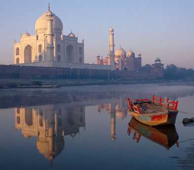
 The Taj Mahal was built on the banks of the river Yamuna, between 1631 and 1643, by the Mughal emperor Shah Jahan as a mausoleum for his beloved wife Arjumand Banu Begum, who was also known by the title Mumtaz Mahal. 

The Taj Mahal was designated as a UNESCO World Heritage Site in 1983 for being “the jewel of Muslim art in India and one of the universally admired masterpieces of the world’s heritage”. It is regarded by many as the best example of Mughal architecture and a symbol of India’s rich history. The Taj Mahal attracts 7–8 million visitors a year and in 2007, it was declared a winner of the New 7 Wonders of the World (2000–2007) initiative.

The Taj Mahal incorporates and expands on design traditions of Persian and earlier Mughal architecture. Specific inspiration came from successful Timurid and Mughal buildings including the Gur-e Amir (the tomb of Timur, progenitor of the Mughal dynasty, in Samarkand), Humayun’s Tomb which inspired the Charbagh gardens and hasht-behesht (architecture) plan of the site, Itmad-Ud-Daulah’s Tomb (sometimes called the Baby Taj), and Shah Jahan’s own Jama Masjid in Delhi. While earlier Mughal buildings were primarily constructed of red sandstone, Shah Jahan promoted the use of white marble inlaid with semi-precious stones. Buildings under his patronage reached new levels of refinement.


Picture Credit : Google

Which is the last Indian State the Himalayan River Ganges enters before flowing into Bangladesh and eventually into the Bay of Bengal?

 West Bengal is the last Indian state that the Ganges enters, and, after it flows into Bangladesh, the Mahananda River joins it from the north. In West Bengal in India, as well as in Bangladesh, the Ganges is locally called the Padma. The westernmost distributaries of the delta are the Bhagirathi and the Hugli (Hooghly) rivers, on the east bank of which stands the huge metropolis of Kolkata (Calcutta). The Hugli itself is joined by two tributaries flowing in from the west, the Damodar and the Rupnarayan. As the Ganges passes from West Bengal into Bangladesh, a number of distributaries branch off to the south into the river’s vast delta. In Bangladesh the Ganges is joined by the mighty Brahmaputra (which is called the Jamuna in Bangladesh) near Goalundo Ghat. The combined stream, there called the Padma, joins with the Meghna River above Chandpur. The waters then flow through the delta region to the Bay of Bengal via innumerable channels, the largest of which is known as the Meghna estuary.

The rivers in the West Bengal area are sluggish; little water passes down them to the sea. In the Bangladeshi delta region, the rivers are broad and active, carrying plentiful water and connected by innumerable creeks. During the rains (June to October) the greater part of the region is flooded to a depth of 3 or more feet (at least 1 metre), leaving the villages and homesteads, which are built on artificially raised land, isolated above the floodwaters. Communication between settlements during that season can be accomplished only by boat.


Picture Credit : Google

How people of different continents are connected to each other?

The seven continents are far apart from each other, but they are all part of the earth. No matter how far apart the continents are, the people who live on them are connected because they have the same needs. In addition to needing food, clothing, and a place to live, they all need to learn, to communicate, and to plan for the future.

Years ago, people knew very little about the continents. The only way they could learn about them was by travelling on ships. Today, TV’s and computers send information around the world with the flick of a switch or the click of a mouse. People watching TV in Australia can see a person rafting down the Amazon River in South America. A scientist in North America can send an instant message to a scientist in Antarctica by computer.

Yes, the continents are very far apart. But transport and technology have brought the people who live on them much closer together.


Picture Credit : Google

Which is the largest lake in Australia?

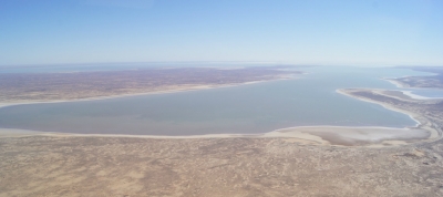
Lake Eyre, officially named Kati Thanda-Lake Eyre, is a large salt water lake in South Australia. The lake derives its name from the first European to discover it, Edward John Eyre. Lake Eyre is mostly dry, but when filled it becomes the largest lake in Australia, occupying an area of 3668 square miles. When Lake Eyre is filled with water, and it springs to life, providing a habitat for migratory birds such as pelicans and sea plants. Lake Eyre falls under two protected areas: Elliot Price Conservation Park and Kati Thanda-Lake Eyre National Park. The South Australian government protects the area surrounding the lake.

The water entering Lake Eyre comes mostly from the rivers from the northeast (in Queensland), which flow down from the Channel Country. A smaller amount of water comes down from Northern Territory from the Finke River catchment, via the Macumba River.

Generally, it takes around 6-8 weeks for water from the Channel Country to reach the lake.

One of the more disturbing facts is that as water fills the lake, the salinity increases and causes a massive fish kill. (Yes, there are about 6 or 7 species of fish which live in the lake!).

Once the lake is full, however, it’s no more salty than the sea. As the lake dries up and the water evaporates, its salinity increases again.

During this time Lake Eyre often appears to turn ‘pink’. This is in fact caused by a pigment found within an algae species that lives in the lake.


Picture Credit : Google

Which is the largest lake in Europe?

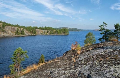
Ladoga is by far Europe’s largest lake with a total surface area of 17 700 square kilometers (6,800 sq mi), which means that it’s larger than both Onega and Vänern combined. 

It’s beautifully located in Karelia in the northwestern part of Russia. Ladoga is ranked as one of the largest lakes in the world (14th) and has an average depth at 51 meters, and maximum depth at 230 meters. 

Visitors can rent a boat to get around the lake and stop for a picnic at one of the 600 islands that are located within its boundaries.

Lake Ladoga famously serves as a source of drinking water for the city. Renowned vodka brand Russian Standard even uses it to create the nation’s favourite tipple (the word vodka is a diminutive of the Russian ‘voda’, meaning water); the company’s vodka scientists go as far as describing the lake water as ‘being alive’.

History aside, Lake Ladoga is a wonder of Nordic beauty, characterized by dense forests and rocky coastlines that can be explored by boat or on foot. The lake boasts an incredibly diverse ecosystem, with nearly 500 species of fish roaming its waters, including carp, bream, perch, and the endangered Atlantic sturgeon, whose eggs are used to make premium caviar.


Picture Credit : Google

Which is the largest lake in Antarctica?

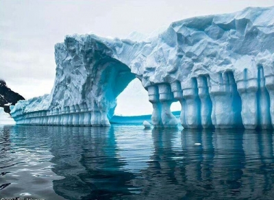
Antarctica is the world’s southernmost continent and is located almost completely south of the Antarctic Circle. It is also the coldest, driest, and windiest continent, and approximately 98% of Antarctica is covered by ice that has an average thickness of nearly 2 km. Despite being largely covered in ice, Antarctica contains numerous lakes and rivers. Many of these lakes are subglacial. The largest of the 400 known subglacial lakes in Antarctica is Lake Vostok, which is located beneath Vostok Station, a Russian research station in Prince Elizabeth Land, Antarctica. Lake Vostok is a freshwater lake situated approximately 4,000 m beneath surface of the ice sheet, which means it is approximately 500 m below sea level.

Lake Vostok was most likely sealed off by a thick ice sheet approximately 15 million years ago. Researchers initially believed the same water had been in the lake since its formation. However, researchers Robin E. Bell and Michael Studinger from Columbia University’s Lamont-Doherty Earth Observatory later proved that the lake’s water was continually freezing and getting carried away by moving ice sheets, and then replaced by water created through the cumulative pressure of the ice sheets. As a result, the entire lake water is replaced approximately every 13,300 years.


Picture Credit : Google

Which is the largest lake in South America?

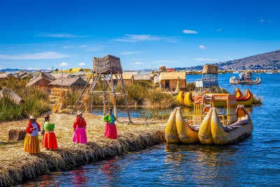
Lake Titicaca is the largest lake in South America by surface area and volume. It covers an area of 3,232 sq mi and holds an average of 214 cu mi of water. It is the world’s “highest navigable lake” at an altitude of 12,507 ft. Titicaca is located within the boundaries of two countries; the western part lies in Puno Region of Peru while the eastern part is located in the Bolivian La Paz Department. The lake consists of two basins connected by the Strait of Tiquina. Five major rivers and more than 20 streams feed Titicaca; the Río Desaguadero is the only outlet. There are 41 islands on the lake most of which are inhabited.

The lake averages between 460 and 600 feet (140 and 180 m) in depth, but the bottom tilts sharply toward the Bolivian shore, reaching its greatest recorded depth of 920 feet (280 m) off Isla Soto in the lake’s northeast corner.

More than 25 rivers empty their waters into Titicaca; the largest, the Ramis, draining about two-fifths of the entire Titicaca Basin, enters the north-western corner of the lake. One small river, the Desaguadero, drains the lake at its southern end. This single outlet empties only 5 percent of the lake’s excess water; the rest is lost by evaporation under the fierce sun and strong winds of the dry Altiplano.


Picture Credit : Google

Which is the largest lake in North America?

The largest lake in North America is Lake Superior. The lake’s name did not initially refer to its enormous size, but was described as “la lac superior” by early French explorers in reference to the fact that it was the only lake upstream from the other Great Lakes of North America. However, in the 1760s the British anglicized the lake’s name to Lake Superior in reference to its massive size. Lake Superior is the largest freshwater lake in the world and covers a total area of 82,100 square miles.

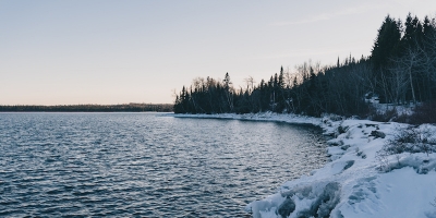
Like all of the Great Lakes, Lake Superior is prone to lake effect snow, but the weather is generally moderate, with warmer temperatures than inland throughout the year. Winter temperatures around the lake rarely fall below minus 30 F (minus 34 C), well above inland temperatures. June and July are calm months, while October and November are prone to storms.

During most winters, the lake is 40 to 95 percent covered with ice, although it rarely completely freezes. The last time Lake Superior froze over was in 2014. Overall, the Great Lakes reached a 91 percent ice cover that year, which is the most the lakes have frozen since 1979. Freezing of the lakes is monitored because it affects hydropower generation, commercial shipping, the fishing industry and more, according to the Office of Oceanic and Atmospheric Research.


Picture Credit : Google