Category Sea/Ocean

WHAT IS SEA LEVEL RISE AND WHY IS IT HAPPENING?

As our planet warms, oceans across the globe absorb a large portion of the heat generated. In the process, the water expands, resulting in universal sea-level rise. In addition, the rise is also caused by the melting of glaciers and icebergs. Usually such melting during warmer months and freezing during colder months is a natural phenomenon. However, with global warming, there’s more of the former than the latter, leading to alarming sea-level rise, threatening to submerge several cities within just a few decades.

Why does sea level change?

Causes sea level to rise because water expands as it warms up; melting of the world’s ice sheets. A large ice mass, which flows over hills and valleys and occupies a large portion of a continent. The world has only three major ice sheets today (Greenland, West Antarctica, and East Antarctica).

In Greenland and Antarctica;  melting of smaller around the world; and decrease in the amount of water held on land, for example, in groundwater beneath the land and in reservoirs above the land. Ocean warming accounts for around half of the observed change in sea level (this is often called “thermal expansion”), with the melting of thousands of small glaciers accounting for the other half of the increase in sea level. Since the 1800s, the melting ice sheets in Antarctica and Greenland have contributed relatively little to sea level change. But, these ice sheets are starting to melt faster due to global warming and may push sea level up much more in the future.

How much could sea level rise?

Because of global warming, the thermal expansion of the ocean and glacier melting will continue to play a role in the rise of sea level in the future . If all of the planet’s remaining as small glaciers were to melt, sea level would rise about 50 cm. The amount that thermal expansion can raise sea level in the future will depend on the continued warming of sea water. The largest possible contribution to sea level rise in the future comes from the world’s large ice sheets in Greenland, West Antarctica, and East Antarctica. If these ice sheets melted completely, the level of the oceans would rise about 7 m from the Greenland ice sheet, 5 m from the West Antarctic ice sheet, and 53 m from the East Antarctic ice sheet. This is why many glaciologists (scientists who study ice) focus on how Greenland and Antarctica are changing because of global warming.

How will sea level rise affect the countries of the world?

The effect of ice sheet melting on sea level is different across the world.

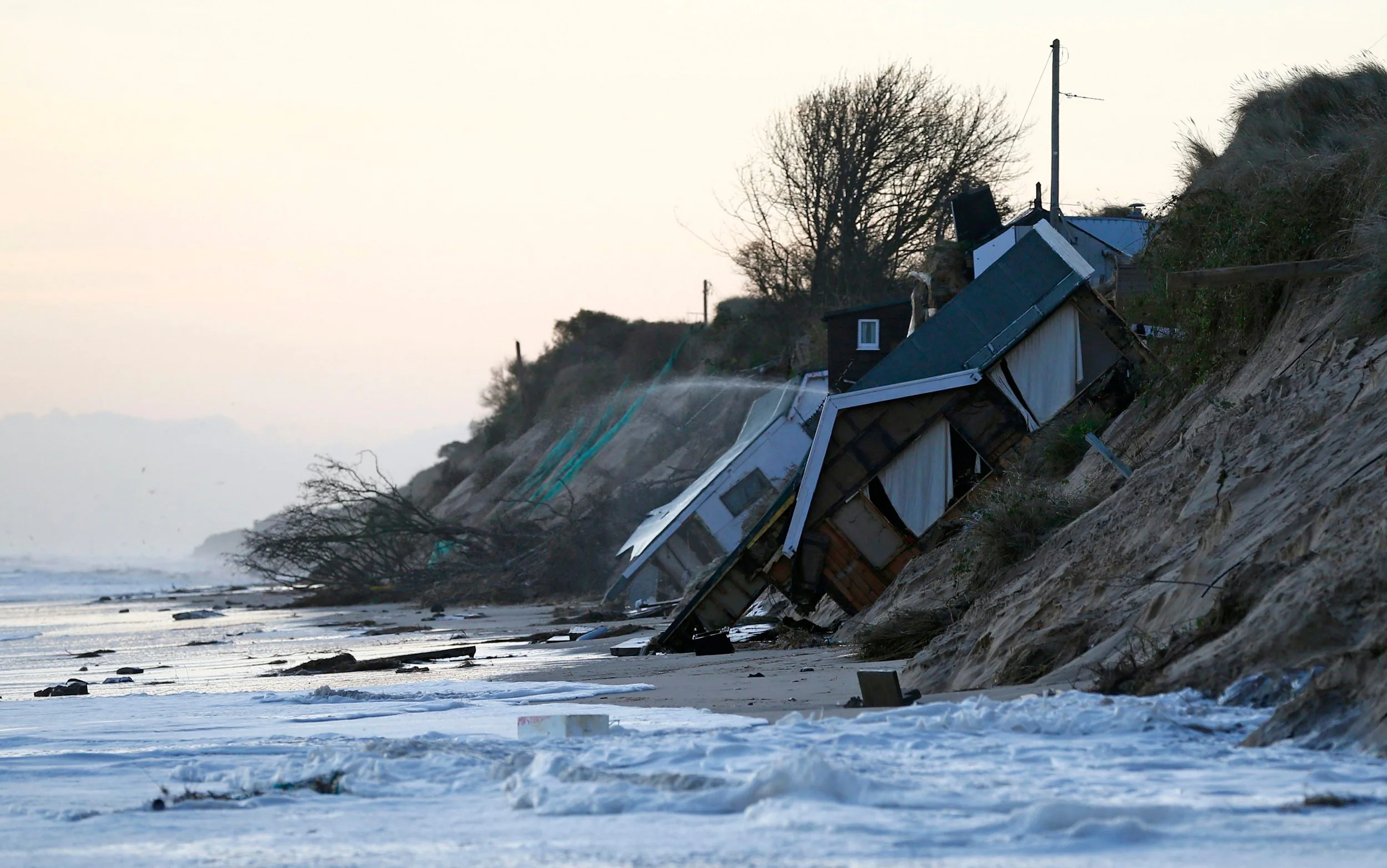
So, when the sea level rises, people will be affected in different ways, depending on where they live. The UK is used to occasionally dealing with rising sea level for short periods of time, particularly when there are storms at the same time as when the tides higher than usual. If the IPCC predictions are correct, we must consider the possible increase in sea level on top of natural tidal surges. This will cause dangerously high tides to occur more often in the coming decades, and these future tides might be more destructive than we are used to.

In farming regions near the coast, seawater flooding on land can contaminate the soils with salt, making them less able to support the growth of crops. The salty water may also get into underground stores of fresh water (known as groundwater), which is the source of important drinking water and also for farmers to grow crops.

In coastal cities, sea level rise will cause more flooding to houses, businesses, and while it may seem sensible to consider moving cities away from harmful floods, especially as we know it will likely happen in the future, our cities cost so much to develop that we are more likely to simply try to protect them from rising sea levels. A vision of our cities near the sea involves them with walls facing the ocean several meters high, with the street level of the cities themselves being below the level of the ever rising sea.

Credit : Frontiers for young mind 

Picture Credit : Google 

WHAT IS PELAGIC ZONE?

The pelagic zone is the open region of any lake, sea, or ocean that is away from any part of land, be it the coast or the sea floor. Marine life-from microscopic plankton and tuna to sharks – dominates this area. Due to the abundance of marine creatures, it is a critical space for producing oxygen, regulating climate, and economic activity.

Pelagic Zone Facts

The pelagic zone plays many critical roles that make it essential to life on Earth. Factors that make the pelagic zone unique include:

It covers more than 50% of the Earth in water, more than 3.2 kilometers (2 miles) deep.
It makes up more than 99% of the inhabitable space on our planet.
The deepest part of the ocean, the Mariana Trench, is about 11,000 meters (7 miles) deep.
The open ocean produces more than 50% of the world’s oxygen.
It is a critical carbon sink, storing 50 times more carbon dioxide than the atmosphere.
Many of its inhabitants never experience sunlight.

The open ocean provides food, medicine, and economic opportunities for people worldwide. In addition to seafood, ocean harvests provide ingredients for foods like peanut butter and soy milk. Medications for Alzheimer’s disease, cancer, heart disease, and arthritis use materials extracted from the ocean, and the United States alone produces $282 billion in ocean-dependent goods and services.

Layers of the Pelagic Zone

The pelagic realm is divided into five distinct regions based on average depth and sunlight availability. Moving from the surface to the ocean floor, the zones are labeled:

Epipelagic
Mesopelagic
Bathypelagic
Abyssopelagic
Hadopelagic

Sunlight, oxygen, and temperature decrease with depth while pressure increases. The organisms in each zone have adapted to live in these conditions.

Credit : Study.com

Pucture Credit : Google 

WHAT ARE KEYSTONE SPECIES?

Keystone species play a unique and crucial role in the functioning of an ecosystem. The animals and organisms that come under this category help to maintain biodiversity within their community either by controlling populations of other species that would otherwise dominate the community or by providing critical resources for the survival of a wide range of organisms.

These species act as the glue that holds the system together. The term was coined by Dr Robert Paine in 1969, to describe the power a single species exerts on an ecosystem. Examples of keystone species include starfish, sea otters, beavers, wolves, elephants, prairiedogs and bees.

Keystone Species Examples

Sea Otter

The sea otter (shown below) is considered a keystone species as their consumption of sea urchins, preventing the destruction of kelp forests caused by the sea urchin population. Kelp forests are a critical habitat for many species in nearshore ecosystems. In the absence of sea otters, sea urchins feed on the nearshore kelp forests, thereby disrupting these nearshore ecosystems. However, when sea otters are present, their consumption of sea urchins restricts the sea urchin population to smaller organisms confined to protective crevices. Thus, the sea otter protects the kelp forests by reducing the local sea urchin population.

Large Mammalian Predators

While small predators are important keystone species in many ecosystems, as mentioned above, large mammalian predators are also considered keystone species in larger ecosystems. For example, the lion, jaguar (shown below), and gray wolf are considered keystone species as they help balance large ecosystems (e.g., Central and South American rainforests) by consuming a wide variety of prey species.

Sea Star

Sea stars (shown below) are another commonly recognized keystone species as they consume mussels in areas without natural predators. In many cases, when the sea star is removed from an ecosystem, the population of mussels proliferates uncontrollably, and negatively effects the resources available to other species within the ecosystem.

Credit :  Biology dictionary  

Picture Credit : Google 

WHAT ARE CORAL REEF?

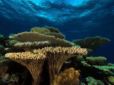
Important ocean habitats that offer us compelling evidence about the risks posed by climate change, coral reefs are large underwater structures made up of the skeletons of colonial marine invertebrates called coral. Also referred to as “the rain forests of the seas”, scientists believe that one out of every four marine species live in and around coral reefs. This makes them one of the most diverse habitats of the planet, providing for a huge portion of Earth’s biodiversity.

Each individual coral is referred to as a polyp. Coral polyps live on the calcium carbonate exoskeletons of their ancestors, adding their own exoskeleton to the existing coral structure. As the centuries pass, the coral reef gradually grows, one tiny exoskeleton at a time, until they become massive features of the marine environment.

Corals are found all over the world’s oceans, from the Aleutian Islands off the coast of Alaska to the warm tropical waters of the Caribbean Sea. The biggest coral reefs are found in the clear, shallow waters of the tropics and subtropics. The largest of these coral reef systems, the Great Barrier Reef in Australia, is more than 1,500 miles long (2,400 kilometers).

Scientists have explored only about 20 percent of the ocean’s floor, according to the National Oceanic and Atmospheric Administration (NOAA). As such, ocean explorers continue to discover previously unknown coral reefs that have likely existed for hundreds of years.

Most of the substantial coral reefs found today are between 5,000 and 10,000 years old, according to CORAL. They are most often found in warm, clear, shallow water where there’s plenty of sunlight to nurture the algae that the coral rely on for food.

Coral reefs cover less than 1 percent of the ocean floor — all the reefs combined would equal an area of about 110,000 square miles (285,000 square km), only about the size of the state of Nevada. Nonetheless, they are among the most productive and diverse ecosystems on Earth.

About 25 percent of all known marine species rely on coral reefs for food, shelter and breeding. Sometimes referred to as “the rainforests of the sea” for their biodiversity, coral reefs are the primary habitat for more than 4,000 species of fish, 700 species of coral and thousands of other plants and animals, according to CORAL.

Coral reefs are typically divided into four categories, according to CORAL: fringing reefs, barrier reefs, patch reefs and atolls. Fringing reefs are the most commonly seen reef and grow near coastlines. Barrier reefs differ from fringing reefs in that they are separated from the coastlines by deeper, wider lagoons. Patch reefs typically grow between fringing and barrier reefs on the island platform or continental shelf. The rings of coral that make up atolls create protected lagoons in the middle of the oceans, typically around islands that have sunk back down into the ocean.

Picture Credit : Google 

WHERE IS THE LARGEST SEAGRASS MEADOW FOUND?

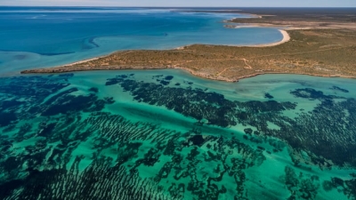
Scientists have discovered the world’s largest plant off the Australia coast- a seagrass meadow that has grown by repeatedly cloning itself. Genetic analysis has revealed that the underwater fields of waving green seagrass are a single organism covering 180 sq.km. through making copies of itself over 4,500 years.

Scientists confirmed that the underwater meadow was a single organism by sampling and comparing the DNA of seagrass shoots across the bed, wrote Jane Edgeloe, a study co-author and marine biologist at the University of Western Australia.

A variety of plants and some animals can reproduce asexually. There are disadvantages to being clones of a single organism. such as increased susceptibility to diseases- but “the process can create hopeful monsters” by enabling rapid growth, the researchers wrote.

The scientists call the meadow of Poseidon’s ribbon weed “the most widespread known clone on Earth”, covering an area larger than Washington, the US.

Though the seagrass meadow is immense, it’s vulnerable. A decade ago, the seagrass covered an additional seven square miles, but cyclones and rising ocean temperatures linked to climate change have recently killed almost a 10th of the ancient seagrass bed.

Did you know?

  • The species is commonly found along parts of Australia’s coast, and grows “like a lawn” up to 35 cm a year, Which is how they arrived at this plant’s age.
  • This specific plant is believed to have spread from a single seed.
  • The plant is hardy, growing in different types of conditions within its present location – from a variety of temperatures and salinities to extreme high light conditions, all of which would have been very stressful to most other plants.
  • A place in the Guinness World Records

The Poseidon’s ribbon weed has entered the Guinness World Records as the “largest single living organism based on area”. The weed has claimed its title from a honey mushroom, which is spread over 2,385 acres in the U.S. The mushroom is still “the world’s largest fungus”.

Picture Credit : Google 

WHY DEAD SEA CALLED DEAD SEA?

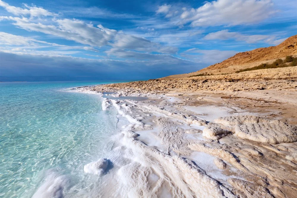
At the very lowest point on earth lies a natural wonder replete with a unique ecosystem, breathtaking desert views, and mineral treasures that have been attracting visitors for thousands of years: The Dead Sea. Located in the desert in southern Israel, it is also the world’s deepest hypersaline lake. Although the high salinity of the water makes it almost impossible to dive, in this article we will delve deep into its geological origins, geography and history, become familiar with the biology and chemistry of this unique environment and discover everything there is to do and where to stay in the area surrounding this natural gem.

The Dead Sea is a salt lake located in the Judean desert of southern Israel, bordered by Jordan to the East. With its origin dating back to some four million years ago, it is one of earth’s saltiest bodies of water and is the lowest point on earth. Its arid desert climate features year-round sunny skies, relatively high temperatures, with little precipitation.

The Dead Sea is located at the lowest point on earth, which is thought to be the result of volcanic processes leading to a continuous dropping of land. It is one of the four saltiest bodies of water in the world. These special conditions are an outcome of its extreme geomorphological structure alongside a harsh desert climate. These create constant dramatic changes that form a landscape that is different from any other in the world. Also, the unique mineral content of the air, land, and water in the area is globally renowned for its therapeutic qualities, as is evident in that it has been a health resort for thousands of years.

There are contending theories about the Dead Sea formation. About 3.7 million years ago, the area now known as the Jordan River Valley was repeatedly flooded by water from the Mediterranean Sea. The waters created a lagoon called the Sedom Lagoon, which connected to the sea through what is currently called the Jezreel Valley. Later on, about 2 million years ago, the land between this lagoon and the Mediterranean Sea rose to such an extent, that the sea could no longer flood the area, leading to the creation of a landlocked lake. Shifts in tectonic plates led to the rising and dropping of the floor of the valley, and the harsh desert climate led to gradual evaporation and shrinking of the lake, until finally, about 70,000 years ago, what remained was the Dead Sea with its low elevation.

Until the end of the 1960s, the Jordan River was the only major water source flowing into the Dead Sea, although there are small perennial springs under and around the lake, forming pools and quicksand pits along its edges. Today, after the diversion of the waters from the Sea of Galilee, the only incoming source of water is from sulfur springs and waste water, along with rare drizzles and flash floods.

Credit : Deadsea.com

Picture Credit : Google