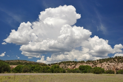
Cumulus clouds are puffy clouds that sometimes look like pieces of floating cotton. The base of each cloud is often flat and may be only 1000 meters (3300 feet) above the ground. The top of the cloud has rounded towers. When the top of the cumulus resembles the head of a cauliflower, it is called cumulus congestus or towering cumulus. These clouds grow upward, and they can develop into a giant cumulonimbus, which is a thunderstorm cloud.
Cumulus clouds can be formed from water vapour, supercooled water droplets, or ice crystals, depending upon the ambient temperature. They come in many distinct subforms and generally cool the earth by reflecting the incoming solar radiation. Cumulus clouds are part of the larger category of free-convective cumuliform clouds, which include cumulonimbus clouds.
Cumulus clouds form via atmospheric convection as air warmed by the surface begins to rise. As the air rises, the temperature drops (following the lapse rate), causing the relative humidity (RH) to rise. If convection reaches a certain level the RH reaches one hundred percent, and the “wet-adiabatic” phase begins. At this point a positive feedback ensues: since the RH is above 100%, water vapor condenses, releasing latent heat, warming the air and spurring further convection.
Picture Credit : Google


