Category Amazing Places

Which place is known as the ‘Cradle of Humankind’?

It is a complex of dolomite caves in South Africa where fossils of early plants, animals and hominids have been found. Read on to know more about the caves where human life originated

About 50 km from Johannesburg in South Africa lies a complex of dolomite caves from where the fossilised remains of a number of early plants, animals and hominids have been found. The cluster of about three dozen caves, of which the Sterkfontein caves are the most famous, are together named the ‘Cradle of Humankind’. They boast over 850 hominid fossils, one of the world’s richest and oldest concentrations of such remains. The site was declared a World Heritage Site in 1999.

The caves offer a window to the past, throwing light on how our ancestors evolved. In 1947, paleontologist Robert Broom found an almost complete skull of a female Australopithecus Africanus, nicknamed ‘Mrs Ples’, dating back 2.8 million years, at Sterkfontein.

More recently in 1997, Ronald Clarke discovered ‘Little Foot, an almost complete hominin skeleton, estimated to be about 3.5 million years old.

Sustained excavation activities since 1966 have so far yielded an impressive 500 hominid specimens from the caves. The hominid remains corroborated the scientific view that the first humans lived in Africa. The fossil evidence has led scientists to believe that early human lineage separated from the apes in Africa about 5-6 million years ago.

The fossil remains from Broom’s excavations are housed in the Transvaal Museum in Pretoria while the finds from 1966 onwards are housed at the University of Witwatersrand, Johannesburg.

Picture Credit : Google 

What is the oldest continuously running restaurant in the world?

Sobrino de Botín in Madrid, Spain, is the oldest running restaurant in the world, according to the Guinness Book of Records. Open since 1725, the restaurant has kept the flame burning in the oven continuously for 293 years, never to be extinguished. World’s oldest restaurant still in operation. At the time that the restaurant opened (in the ground floor of an inn), it was actually up to the guests to bring their own meat and ingredients, which were then cooked in the eatery’s facilities. After the original owners died childless, the restaurant passed to their nephew, which is when it got its current name, which translates to “Nephew of Botin,” of course.

Over the next 200-plus years, the trends of the city changed, but Sobrino de Botin never stopped cooking (after it was able to start cooking for for people that is). Today the restaurant covers four floors of seating, each with its own Spanish theme, from the brick cellar to the fancier Felipe IV room. Even as the tourists began to flock to the restaurant, as will happen once Guinness gets its paws on you, the cuisine has stayed remarkably true to its Spanish roots, with the whole suckling pig, which is prepared in a brick oven, being the standout dish.

The Sobrino de Botin likely saw its finest moment when it was mentioned by Ernest Hemingway in The Sun Also Rises, and it is rumored that the famous artist Francisco de Goya worked there as a young man. However, its legacy is clearly thanks to its astounding age rather than to its ties to art and literature.

Credit : Slate.com

Picture Credit : Google 

Which is the world’s first ice hotel?

Icehotel, the world’s first ice hotel, has been melting and being rebuilt since 1990, and is one of the Seven Wonders of Sweden. Located in Jukkasjarvi village, the 64,600 sq foot hotel is rebuilt each year with snow and ice from the Torne River. The hotel exists from December until mid-April when it melts and returns to the river. It has around 100 rooms designed by artists from all over the world who vie annually for the opportunity to design one of the rooms. The hotel features chandeliers, furnishings, running fountains and statuary, all crafted of ice and snow. It hosts an ice chape, an ice restaurant, and a bar with glasses made of ice! The entire structure remains below freezing, around -5 degree C.

Given that climate control is one of the biggest challenges, steel pipes are drilled into the permafrost (at 16 feet below ground) to keep the building at 23 degrees (Fahrenheit)—the ideal temperature for the preservation of the hotel plus its ice and snow sculptures, according to Bergqvist. “That way, the building works like a thermos where it doesn’t let the cold air out nor the heat in,” he said. What’s more, approximately 7,320 square feet of solar-powered refrigerating plants will be used to keep the hotel cool during the summer months too.


Picture Credit : Google

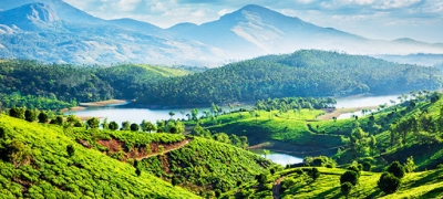
Which hill station is close to Eravikulam National Park, which houses the endangered Nilgiri tahr?

The Eravikulam National Park, spread over 97 sq km, is a green paradise which is home to rare flora, fauna and wildlife. However, the biggest attraction of the park is Nilgiri Tahr (Nilgiritragus hylocrius), an endangered species of mountain goat. Around one-third of the world’s population of this species lives in this park. Neelakurinji, the plant which flowers once in twelve years, grows in abundance here making the park a must-visit place during the kurinji flowering season. Anamudi, the highest peak in South India, is situated in the park. The Eravikulam National Park is around 13 km away from Munnar town.
The Nilgiri tahr is a congener of the Himalayan tahr (Hemitragus jemlahicus), found in Kashmir and Bhutan and the Arabian tahr (Arabitragus jayakari), found in Oman and United Arab Emirates. The Nilgiri tahr is one of the few species of mountain Caprinae, and the only Tahr, which is adapted to a cold and wet tropical environment. The species is diurnal, but are most active grazing in the early morning and late afternoon.

The Nilgiri tahr inhabits the open montane grassland habitat of the South Western Ghats montane rain forests ecoregion. At elevations from 1,200 to 2,600 m (3,900 to 8,500 ft), the forests open into large grasslands interspersed with pockets of stunted forests, locally known as sholas. These grassland habitats are surrounded by dense forests at the lower elevations. The Nilgiri tahrs formerly ranged over these grasslands in large herds, but hunting and poaching in the 19th century reduced their population.


Picture Credit : Google

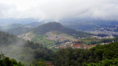
What is the official name of Ooty?

Udhagamandalam, also spelled Uthagamandalam, formerly Ootacamund, also called Ooty, town, western Tamil Nadu state, southern India. It is situated in the Nilgiri Hills at an elevation of about 7,500 feet (2,300 metres) above sea level and is sheltered by several peaks—including Doda Betta (8,652 feet [2,637 metres]), the highest point in Tamil Nadu.

Ooty lake is an artificial lake constructed by John Sullivan, in 1824. The water flowing down mountain streams in the Ooty valley was dammed to form the lake. The lake became empty on three occasions when it breached its bund. The lake was originally intended to be used for fishing with ferries being used to travel across the lake. It gradually shrunk from its original size giving place to the current bus stand race course, and the lake park. The Tamil Nadu Tourism Development Corporation on behalf of the Tourism Department took the possession of the lake in 1973, for providing boating facilities as a tourist attraction.

The boat house, which adjoins the lake, was opened by the Tamil Nadu Tourism Development Corporation (TTDC). Boating is the prime attraction at the lake. The boat house offers boating facilities with Paddle boats, Row boats, and Motor boats. It also features a garden, a mini train and an amusement park. The other notable features include a canteen run by the TTDC and pony rides in front of the boat house.

Other fun activity inside ooty lake Mini train especially for kids 7D cinema Horror and Mirror House cost Dashing car Break-dance and Columbus

Other things to do nearby Ooty Lake Horse ride cycling.


Picture Credit : Google

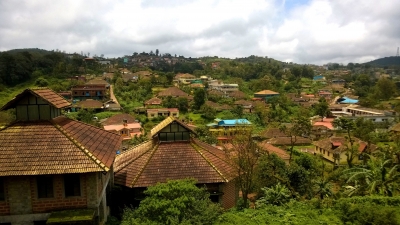
Which hill town is the headquarters of the Kodagu district?

Kodagu is a hilly district of Karnataka popularly called as Coorg. This hilly region is a part of Western Ghat and it covers an area of 4103 sq. km. located about 257 km away from state capital, Bangalore. Madikeri is the main town of Coorg and it also serve as the district headquarters. Other major cities of the Kodagu are Virajpet, Kushalanagara and Somwarpet. Coorg District is divided into the three talukas namely Madikeri, Virajpet and Somwarpet.

Coorg is a lovely hill station for the travelers where you will find several beautiful waterfalls, tea & coffee estates and lovely site scenes including lots of religious places.

You also search out lots of famous peeks here like Tadiandamol, Kote Betta, Pushpagiri, Nishani Motte, Tumbe Male, etc. Larger amounts of population in Coorg are considered as Kodava regional community and they usually utilize Kodagu Takk or Coorgi Language as their prime dialect. Some other major communities of the state are Gowdas, Tamilians, Malayalees, Muslims, Kurubas, Kudiyas, Yeravas, etc.

As per 2011 census report of India about 554764 people reside in Coorg. Maximum of population follows Hinduism (warrior class or Kshatriya’s) as their religions. We know the Coorgi language is main dialect of the district but Kannada Language is accepted as official language of Coorg. English-written widely uses for educational purpose in this hilly region.


Picture Credit : Google