Category Environment

What is diamond planet?

Imagine walking on a planet that is full of diamond. Dubbed 55 Cancri e, an exoplanet twice the size of Earth, is composed of carbon mostly in the form of graphite and diamond. At least a third of the planet’s mass is likely diamond as a result of the temperatures and pressures in the planet’s interior. Further observations are necessary to confirm the nature of the planet. It orbits a Sun-like hot star called 55 Cancri A. Planets like this are vastly different from our Earth, which has relatively less carbon.

Astronomers discovered the planet in 2004 after looking at the spectrum of its parent star, 55 Cancri A, one of two stars in a binary system about 40 light-years from Earth in the constellation Cancer. There are at least four other planets in the same system, mostly discovered before 55 Cancri e. The team (led by the University of Texas at Austin’s Barbara McArthur) discovered subtle tugs on the parent star that could be explained by the presence of yet another planet. While the planet’s existence was challenged by a second research team in 2005, a separate team in 2006 confirmed it. 

Astronomers initially thought 55 Cancri e (abbreviated 55 Cnc e) had an orbital period of 2.8 days, but measurements in 2011 showed that the planet is much closer to its parent star. Observations with Canada’s MOST (Microvariability & Oscillations of STars) space telescope demonstrated an orbital period of less than 18 hours. Researchers estimated the surface temperature of 55 Cancri e could be as high as 4,892 F (2,700 C). 

Follow-up observations with the Spitzer Space Telescope in 2012 showed that 55 Cancri e is much weirder than anticipated. While original estimates said the planet was dense and rocky, Spitzer suggested the planet includes a healthy proportion of light elements and compounds (such as water). However, the planet’s high surface temperatures contribute to a “supercritical” fluid state, the researchers said, meaning that the gases are in a liquid-like state. 

Credit : Space.com

Picture Credit : Google 


Is Meghalaya the wettest place on Earth?

Mawsynram in Meghalaya is the wettest place, based on rainfall in the world. Located in the Khasi Hills, it receives about 11,872mm (nearly 467 inches) of average annual rainfall According to the Guinness Book of World Records, the region received 26,000mm of rainfall in 1985. The mountainous terrain of Mawsynram and the nearby Cherrapunji, the second wettest place, are known for their lush greenery and scenic beauty The “living bridges are one of the most beautiful features of this region. These have been created by the local people by training the roots of rubber trees into natural bridges. With the root systems constantly growing, these bridges are self-sustaining.

Primarily due to the high altitude, it seldom gets truly hot in Mawsynram. Average monthly temperatures range from around 11 °C in January to just above 20 °C in August. The village also experiences a brief but noticeably drier season from December until February, when monthly precipitation on average does not exceed 30 millimetres (1.2 in). The little precipitation during the village’s “low sun” season is something that is shared by many areas with this type of climate.

Three reasons can be cited for high rainfall at Mawsynram:

The warm moist winds of the northward-moving air from the Bay of Bengal during the monsoon, which cover an extensive area but are forced to converge into the narrower zone over the Khasi Hills, thus concentrating their moisture.
The alignment of the Khasi Hills (east to west) places them directly in the path of the airflow from the Bay of Bengal, producing a significant uplift (plus cooling, further condensation and thus more rain).
Finally, uplift over the Khasi Hills is virtually continuous in the monsoon period because the lifted air is constantly being pulled up by vigorous winds in the upper atmosphere; hence, the rainfall is more or less continuous.

Credit : Wikipedia 

Picture Credit : Google 

WHAT IS THE DIFFERENCE BETWEEN RAIN AND PRECIPITATION?

When a lot of water vapour fills the air, it begins to change and condense into droplets of water. These droplets fall back onto Earth as precipitation, which can take many forms – rain, hail, snow, sleet, fog, dew. So rain is just one form of precipitation.

The difference between Rainfall and Precipitation is that the Rainfall is a liquid water in the form of droplets that have condensed from atmospheric water vapor and then precipitated and Precipitation is a product of the condensation of atmospheric water vapour that falls under gravity.

Rainfall

Rain is liquid water in the form of droplets that have condensed from atmospheric water vapor and then becomes heavy enough to fall under gravity. Rain is a major component of the water cycle and is responsible for depositing most of the fresh water on the Earth. It provides suitable conditions for many types of ecosystems, as well as water for hydroelectric power plants and crop irrigation.

The major cause of rain production is moisture moving along three-dimensional zones of temperature and moisture contrasts known as weather fronts. If enough moisture and upward motion is present, precipitation falls from convective clouds (those with strong upward vertical motion) such as cumulonimbus (thunder clouds) which can organize into narrow rainbands. In mountainous areas, heavy precipitation is possible where upslope flow is maximized within windward sides of the terrain at elevation which forces moist air to condense and fall out as rainfall along the sides of mountains. On the leeward side of mountains, desert climates can exist due to the dry air caused by downslope flow which causes heating and drying of the air mass. The movement of the monsoon trough, or intertropical convergence zone, brings rainy seasons to savannah climes.

The urban heat island effect leads to increased rainfall, both in amounts and intensity, downwind of cities. Global warming is also causing changes in the precipitation pattern globally, including wetter conditions across eastern North America and drier conditions in the tropics. Antarctica is the driest continent. The globally averaged annual precipitation over land is 715 mm (28.1 in), but over the whole Earth it is much higher at 990 mm (39 in). Climate classification systems such as the Köppen classification system use average annual rainfall to help differentiate between differing climate regimes. Rainfall is measured using rain gauges. Rainfall amounts can be estimated by weather radar.

Rain is also known or suspected on other planets, where it may be composed of methane, neon, sulfuric acid, or even iron rather than water.

Precipitation

In meteorology, precipitation is any product of the condensation of atmospheric water vapor that falls under gravity. The main forms of precipitation include drizzle, rain, sleet, snow, graupel and hail. Precipitation occurs when a portion of the atmosphere becomes saturated with water vapor, so that the water condenses and “precipitates”. Thus, fog and mist are not precipitation but suspensions, because the water vapor does not condense sufficiently to precipitate. Two processes, possibly acting together, can lead to air becoming saturated: cooling the air or adding water vapor to the air. Precipitation forms as smaller droplets coalesce via collision with other rain drops or ice crystals within a cloud. Short, intense periods of rain in scattered locations are called “showers.”

Moisture that is lifted or otherwise forced to rise over a layer of sub-freezing air at the surface may be condensed into clouds and rain. This process is typically active when freezing rain occurs. A stationary front is often present near the area of freezing rain and serves as the foci for forcing and rising air. Provided necessary and sufficient atmospheric moisture content, the moisture within the rising air will condense into clouds, namely stratus and cumulonimbus. Eventually, the cloud droplets will grow large enough to form raindrops and descend toward the Earth where they will freeze on contact with exposed objects. Where relatively warm water bodies are present, for example due to water evaporation from lakes, lake-effect snowfall becomes a concern downwind of the warm lakes within the cold cyclonic flow around the backside of extra tropical cyclones. Lake-effect snowfall can be locally heavy. Thunder snow is possible within a cyclone’s comma head and within lake effect precipitation bands. In mountainous areas, heavy precipitation is possible where upslope flow is maximized within windward sides of the terrain at elevation. On the leeward side of mountains, desert climates can exist due to the dry air caused by compressional heating. Most precipitation occurs within the tropics and is caused by convection. The movement of the monsoon trough, or inter-tropical convergence zone, brings rainy seasons to savannah climes.

Precipitation is a major component of the water cycle, and is responsible for depositing the fresh water on the planet. Approximately 505,000 cubic kilometres (121,000 cu mi) of waterfalls as precipitation each year; 398,000 cubic kilometres (95,000 cu mi) of it over the oceans and 107,000 cubic kilometres (26,000 cu mi) over land. Given the Earth’s surface area, that means the globally averaged annual precipitation is 990 millimetres (39 in), but over land it is only 715 millimetres (28.1 in). Climate classification systems such as the Köppen climate classification system use average annual rainfall to help differentiate between differing climate regimes.

Precipitation may occur on other celestial bodies, e.g. when it gets cold, Mars has precipitation which most likely takes the form of frost, rather than rain or snow.

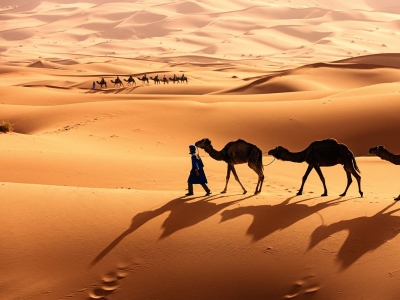
Credit: maindifference.net

Picture credit: Google

Which is the largest hot desert?

The Sahara in North Africa is the largest hot desert and the third largest desert in the world. Spread over an area of 9.4 million sq km, the desert covers large sections of as many as 11 countries such as Egypt Libya. Tunisia, Algeria, Morocco and Sudan. Did you know only one quarter of the desert is sandy? The rest is made up of rocky plateaus, gravel, salt flats, dry valleys and oases.

The Sahara is bordered by the Atlantic Ocean to the west, the Red Sea to the east, the Mediterranean Sea to the north and the Sahel savanna to the south. The enormous desert spans 10 countries (Algeria, Chad, Egypt, Libya, Mali, Mauritania, Morocco, Niger, Sudan and Tunisia) as well as the territory of Western Sahara, a former Spanish colony that was annexed by Morocco in 1975, though control of the region is disputed by the Indigenous Saharawi people.

The Sahara desert has a variety of land features, but it is most famous for the sand dune fields that are often depicted in movies. The dunes can reach almost 600 feet (183 meters) high, and they cover about 25% of the entire desert, according to the Encyclopedia Britannica. Other topographical features include mountains, plateaus, sand- and gravel-covered plains, salt flats, basins and depressions. Emi Koussi, an extinct volcano in Chad, is the highest point in the Sahara, reaching 11,204 feet (3,415 m) above sea level,  and the Qattara Depression in northwestern Egypt is the Sahara’s deepest point, at 436 feet (133 m) below sea level.

Despite the harsh, arid conditions of the Sahara, many plant and animal species call the region home. Approximately 500 plant species, 70 mammalian species, 90 avian species, 100 reptilian species and numerous species of spiders, scorpions and other small arthropods live in the Sahara. The camel is one of the most iconic animals of the Sahara, though its ancestors originated in North America. Other mammal residents of the Sahara include gazelles, addaxes (a type of antelope), cheetahs, caracals, desert foxes and wild dogs. Many reptiles also thrive in the desert environment, including several species of snakes, lizards and even crocodiles in places where there is enough water. Several arthropod species also call the Sahara home, such as dung beetles, scarab beetles, “deathstalker” scorpions and many types of ants.

Today, the Sahara has a dry, inhospitable desert climate. The past 2,000 years or so, the climate of the Sahara has been fairly stable — and dry. The northeastern winds strip moisture from the air over the desert and drive hot winds toward the equator.

Credit : Live science

Picture Credit : Google 

Which insect is named after Greta Thunberg?

Did you know a beetle species in 2019 was named after Swedish climate activist Greta Thunberg in recognition of her contribution towards creating awareness about climate change? Called Nelloptodes gretae the tiny beetle belongs to the Ptiliidae family of beetles. The beetle is less than 1 millimeter long. They have no eyes or wings and are a pale yellow and gold color. . Nelloptodes gretae belongs to a group of some of the smallest known free-living animals, London’s Natural History Museum said Friday.

The species is fitting for the Swedish 16-year-old. “Many people say that Sweden is just a small country and it doesn’t matter what we do,” Thunberg once said. “But I’ve learned that you are never too small to make a difference.” Not to mention the beetle’s antennae, which resemble Thunberg’s signature pigtail braids.

Michael Darby, a scientific associate at the museum who found the insect during his studies of the museum’s vast collection, chose the name to honor Thunberg’s contribution to saving the planet.

Nelloptodes gretae was first discovered in Kenya in the 1960s by entomologist William Block, who donated the samples to the museum, where they have stayed ever since. Thunberg has become known worldwide for her weekly climate strikes, which she started on her own in 2018. Since then, the teenager has inspired millions of people to spend their Fridays urging their governments to take action against climate change.  Her movement has resulted in the largest climate protests in history.

Credit : CBS news

Picture Credit : Google 

What is special about Lake Tuz or Tuz Golu lake?

Lake Tuz or Tuz Golu is Turkey’s second largest lake. One of the largest hypersaline lakes in the world. Lake Tuz has a surface area of over 1,600 sq km. It is said that salt extracted from the lake is exported to more than 60 countries.

Lake Tuz is a saline lake (Tuz is Turkish for “salt”) located on the Central Anatolia plateau, about 150 kilometers (90 miles) south-southeast of Ankara. It is fed by groundwater that originates in the Northern Taurus Mountains and passes through Konya Plain and Obruk Plateau bubbles up into Lake Tuz via springs. Other sources of water include two major streams, and rain that primarily falls in the springtime. The lake has no outlet.

Water here has become increasingly scarce. The Mediterranean Basin, which includes Turkey, has already seen more frequent and intense droughts, according to a report by the Mediterranean Experts on Climate and Environmental Change. In addition, the Mediterranean Basin is considered a climate change hotspot, having warmed more since the pre-industrial period compared to the global average (1.5°C/2.7°F compared to 1.1°C/2.0°F).

After the year 2000, there was a distinct shift. Between 2001 and 2016, water spanned less than 20 percent of the lake in every August (except 2015) as droughts became more frequent and intense. In 2008 and 2016, the lake completely dried up. Aydin-Kandemir’s current research shows that more recently, extraordinary meteorological drought has devastated Lake Tuz since 2019. The patterns led the scientists to wonder why the lake had become more sensitive to drought after the year 2000. Before that time, Lake Tuz usually contained water even during periods of drought. But something changed.

Credit : Sci Tech Daily

Picture Credit : Google