Category Sea/Ocean

What is Indian ocean Dipole?

With climate change wreaking havoc all across the globe, you must have come across the weather phenomena El Nino and La Nina. But have you heard of the Indian Nino? Come let’s find out what it is and how it impacts the monsoon

A climate phenomenon

El Nino is a naturally occurring climate pattern associated with the abnormal warming of surface waters in the central Pacific Ocean and this will push up global temperatures and bring less-than-normal rainfall to many parts of the world, while La Nina refers to the large-scale cooling of surface temperatures in the central and eastern Pacific Ocean. With an El Nino phase now underway, the warm water spreading across the Pacific Ocean releases a large amount of heat into the atmosphere and this results in hot and dry weather conditions in many parts of the world. So what happens climatically in one place will affect weather worldwide. If there is an El Nino developing in the Pacific, it changes the winds and atmospheric circulation over the Indian Ocean.

warming it up. The Indian Ocean Dipole (1OD), which is commonly referred to as the Indian Nino, is a similar climate phenomenon playing out in the Indian Ocean, the world’s third largest ocean after the Pacific and Atlantic Oceans. The Indian Ocean most of which lies in the tropical region. is bounded by Africa to the west by Asia to the north, by Australia and the islands of indonesia to the east, and by the Southern Ocean to the south. So the IOD plays out between the African coastline in the west and indonesian coastline in the east, that is between the westem and easter parts of the Indian Ocean

Phases of IOD

The IOD is an irregular shift of ocean surface temperatures in which the western Indian Ocean gets alternately wanner and colder than the eastem part. That is if the temperature of the ocean is warmer on the westem side, it is cooler on the opposite side. The Indian Ocean Dipole plays an important role in influencing weather patterns, particularly the monsoon season in India. It is known to have two main phases, positive and negative, which have their distinct impact on the monsoon.

The rainfall tends to move with the warm waters. During a positive phase, warm waters are pushed to the western part of the Indian Ocean resulting in greater-than-average surface sea temperatures and a greater-than-normal rainfall, while cold waters from the deep are brought to the surface in the eastern Indian Ocean. In other words, a positive IOD means a wetter west and a drier east. The IOD is said to be negative when the western Indian Ocean gets cooler. This fluctuation in temperatures leads to changes in atmospheric circulation patterns, affecting the monsoon.

A positive phase of the IOD enhances the monsoon flow to India and causes floods in African countries, while it reduces rainfall and causes drier conditions and droughts in Indonesia and Australia. This pattern gets reversed during the negative phase. According to the India Meteorological Department (IMD). there is a higher probability for positive IOD conditions this year and this could potentially limit the impact of El Nino on the subcontinent.

Picture Credit: Google

What is an underwater forest?

Imagine a forest underwater or a tapestry of green inside the ocean. That’s just what a kelp forest is. Though kelps are considered the forests of the sea and look like plants, they are not plants. Kelps are large brown algae, and together, the different species of kelps form kelp forests.

The kelp forests figure among one of the most dynamic and diverse ecosystems on earth and offer a habitat for marine organisms such as invertebrates, fishes, and other algae and play many key ecological roles.

Kelps cover 25% of the world’s coastlines. They provide food and shelter to marine animals. These can be seen around the world, across polar as well as temperate coastal oceans. They live in cold waters that are rich in nutrients.

While they remain attached to the seafloor, they grow towards the surface of the water and depend on sunlight to generate food. The ideal physical conditions are satisfied, then kelps can grow 45 cm a day. Some of these species are seen to measure up to even 45 m long.

Kelps and climate change

Kelp forests play a highly crucial role in battling climate change as they are good at sequestering carbon, thereby ensuring the health of the coastal environment. They are also capable of absorbing excess nitrogen and phosphorus that nun into the oceans from the land. Studies have shown that a third of the globe’s coastal environments depend on kelp to combat local pollution and sustain fisheries. Apart from helping maintain the health of the marine ecosystem, kelps are also commercially harvested as they find applications in food production, textiles, pharmaceuticals, and so on.

The health of the kelps is dependent largely on oceanographic conditions and as such they can disappear and reappear based on this. For instance, sea urchins can destroy the kelp forests. Moreover, strong individual storms can affect the kelp forests by tearing out the kelps from the floor of the sea.

These dense canopies of algae are also facing many threats. Water pollution, rising sea temperatures, overgrazing, overfishing, and water pollution are some of the reasons for the depletion of kelp forests.

Studies prove that Southern Australia and Northern Califonia have lost 95% of their kelp forests. Their depletion is seen along the coastlines of every continent and this affects the fish, livelihoods and economy that are supported by the kelp forests.

Picture Credit : Google

Are heatwaves Present in the ocean?

High temperatures and heatwaves across the globe saw records broken in July 2023 on land and in the oceans. The oceans serve as the Earth’s heat reservoir, absorbing substantial amounts of thermal energy as a result of their continuous interaction with the atmosphere. Under specific conditions prolonged periods of unusually high temperatures in the oceans are called marine heatwaves much like their atmospheric counterparts.These higher temperatures could be driven by increased heat input from the atmosphere. decreased heat losses from the ocean or the transfer of warmer water masses through currents Over the past two decades these events have become more prevalent and widespread, having been observed in various areas of the global ocean, in both regional and large scales, at the surface of the ocean and at depth

In particular, recent data shows the occurrence of marine heatwaves surged by 34 percent between 1925 and 2016. While the exact mechanisms triggering marine heatwaves vary from region to region. There are two primary factors. In some instances, the atmospheric conditions themselves play a pivotal role. During such episodes, stagnant air masses and prolonged high temperatures in the atmosphere conspire to heat the ocean’s surface setting the stage for a marine heatwave event. This pattern was notably evident during a 2012 North Atlantic event, which saw one of the highest sea surface temperatures ever recorded.

In other cases, the main driver is the movement of ocean currents, which transport relatively warm water masses to new areas. When these warm masses converge in specific regions, they cause a rapid and abrupt increase in the sea’s surface temperature. This was witnessed in the 2015 Tasman Sea (situated between Australia and New Zealand) event.

As the impacts of marine heatwaves reverberate across the globe, understanding the complex interplay between the oceans and the atmosphere is crucial for predicting the Occurrence of these extreme events. In the face of climate change, conserving and protecting our oceans becomes ever more critical. Therefore improving marine heatwave predictability is crucial to empower communities and ecosystems alike to adapt and build resilience. By better understanding the science behind marine heatwaves and taking collective action, people can work towards a more resilient and sustainable future for the oceans. (With inputs from agencies).

Picture Credit : Google

Is the color of the oceans changing?

The color of over 56 per cent of the worlits oceans larger than Earths total laut eganse, has changed significantly over the last two decades and human-caused dimate change is likely the driver, according to researchers

These colour changes, subtle to the human eye, cannot be explained by natural, year-to-year variability alone. Ocean colour, a literal reflection of the life and materials in its waters, in regions near the equator was found to have steadily turned greener over time, indicating changes in the ecosystems within the surface oceans.

The green colour of the ocean waters comes from the green pigment chlorophyll present in phytoplankton. the plant-like microbes abundant in upper ocean Scientists are, therefore, keen to monitor phytoplankton to see their response to climate change

The researchers from the Massachusetts Institute of Technology (MIT), US, and other institutes in their paper published in the joumal Nature, say that it would take 30 years of tracking chlorophyll changes before climate-change-driven trends would show, because natural, annual variations in chlorophyll would overwhelm those influenced by human activities.

In a 2019 paper, study co-author Stephanie Dutkiewicz and her colleagues showed that monitoring other ocean colours whose annual variations are much smaller than those of chlorophyll, would convey mom dear signals of climate-change-driven changes and that they might even be apparent in 20 years, rather than 30.

“It’s worth looking at the whole spectrum, rather than just trying to estimate one number from bits of the spectrum.” said lead author B. B. Cael of the National Oceanography Center. Cael and team then statistically analysed all the seven ocean colours recorded by satellite observations from 2002 to 2022 together.

To understand climate changes contribution to all these changes, he used Dutkiewicz’s 2019 model to simulate the Earth’s oceans under two scenarios-one with greenhouse gases and the other without them. The greenhouse gas model predicted changes to the colour of about 50 per cent of the world’s surface oceans in under 20 years close to Cael’s conclusions from his real-world satellite data analysis. “This trend is consistent with anthropogenic climate change”

Picture Credit: google

What are sand dollars?

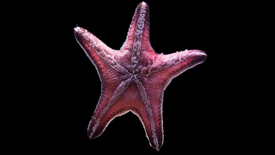
When alive, they look like huge coins with their flat, disk-shaped body. But mostly you would come across them when they have deceased. You might notice these patterned white shells in the sand. These star-stamped skeletons (tests) are much sought-after by beachcombers. (But let us warn you, it is never advised to pick up these creatures, dead or alive). Meet sand dollars, the bottom-dwelling creatures in the ocean.

Also called sea biscuits or sand cakes, the sand dollars belong to the order Clypeastroida. They are close relatives of sea urchins and heart urchins and are adapted to burrow themselves in sandy substrates. They dwell in the tropical and temperate waters throughout the Northern Hemisphere. Measuring from 5 to 10 cm in diameter, the sand dollars are invertebrates belonging to the class of marine animals known as echinoids. They have a radiating arrangement of parts.

The holes in their skeleton are what you notice first. But these aren’t there just for design sake. Arranged in a unique petal fashion these sets of gas-and water-processing pores are called lunules and act as pressure drainage channels.

The upper surface of their body showcases what is called pentaradiate (five-fold) symmetry From its centre, a pattern of five “petals” spread out. The mouth of this unique creature is located at the centre of its body’s underside.

While alive, the sand dollars have bristles known as spines which even cover their star design and they appear in hues ranging from reddish-brown to purple. When they die, these skeletons turn white, bleached by the sun, which is how you may often find them on the beach.

They breathe through the “petaloids”, a set of tiny holes in the skeleton. They live in the sand, using their spines to burrow into the sand. If the water is still, they can be seen standing upright, with one of their ends buried in the sand and they lie down or burrow themselves under the sand if the waters get rough.

Adult sand dollars live on the sea floor while the larva (also called pluteus) floats among the ocean’s planktons. The juveniles are seen in the subtidal zones while the adult sand dollars live in the intertidal zone.

Some of the threats these creatures face include bottom trawling, ocean acidification, climate change and so on. It is illegal to remove the sand dollars in most regions. Why we suggest that you should never pick them up is that you may not know if they are dead or alive. They can survive out of water for only a few minutes.

TRIVIA

* Sand dollars use their spines to eat. They feed on small food particles in the sand and are said to take two whole days to digest food.

* The creature gets its name from the resemblance it has to dollar coins. Other names include “sand cake,” “sea biscuit,” “cake urchin,” “pansy shell”, “sea cookie” and so on.

* A sand dollars age can be ascertained by the number of rings it sports on the plates of the creature’s test. As they grow, the number of rings increases.

* The larva of the sand dollar splits itself into two identical clones to hide from predators.

* The mouth of a sand dollar is called Aristotle’s lantern.

Picture Credit : Google

What can be done to conserve save the population of fish?

As fish populations decrease globally, researchers assert that the focus should be on working with other countries rather than on just local numbers. Why is that? Come, let’s find out.

Political boundaries are the work of humans. Wildlife do not recognise them. And, fish are no different. Dwelling in water bodies, they freely cross countries. Studies have indicated that there a few fish species that “migrate over long distances”. As it happens, fish egg and/or larvae may originate in one place and be carried to faraway places (this could be to even other countries), thanks to ocean currents. “Often one nation’s fish stocks depend on the spawning grounds of a neighboring country, where fish release eggs and sperm into the water and Larvae hatch from fertilized eggs.”

A recent study has discovered that “global fisheries are even more tightly connected than previously understood”. With fish and spawn connected to several regions, the world’s coastal marine fisheries are essentially “a single network”, aided by ocean currents. Ocean current patterns vary with seasons. But, mostly these currents are sluggish (though there are a few regions where the currents are faster). Despite this, spawn can travel far. Here’s an example. “Even a gentle current of 0.1 miles per hour can carry spawn 40 miles over a month, and some species can float for several months.” Add to this the fact that different “fish species spawn in different seasons, and a single species may spawn in several months at different locations”, and what we get is fish species in one country steadily arriving from or drifting to other countries over different periods of time.

So what happens is that if fish populations in one region dwindle. “the amount of fish spawn, or eggs and larvae, riding the ocean currents from there to other countries would also decline dramatically, resulting in further loss of fish elsewhere”. To ensure food security and employment to those dependent on fishing, it is important for countries to understand this deep interconnectedness of global waters and chalk out ways to guard them.

Picture Credit : Google